

Compiled by Pete Richardson
Main Screen Overlay image- Park layout on Streets Photos around the park Comments/New Content
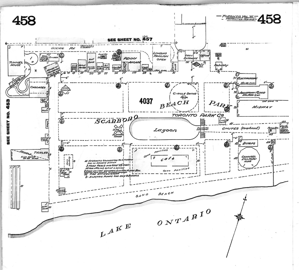
| Scarboro’ Beach Amusement Park was a major Toronto attraction that operated between 1907 and 1925. It was located on Lake Ontario in the Beach neighbourhood south of Queen Street East between Leuty and Maclean Avenues
I live in one of the Price Bros fourplexes that were constructed after the park closed, and long have wondered:
The maps and images contained in this article are a pictorial overview detailing: - current streets overlayed on the original park outline - views you would see as if you were standing in a specific place in park. The only remaining evidence of the park is this plaque located on the north side of the boardwalk, below Scarboro Beach Boulevard, shown here on the right. An excellent history of the park can be found in the The Beach in Pictures book prepared by Barb Myrvold and Mary Campbell.In addition, you can view Ray Corley's historical timeline of the park.
Here is another great image of the park attractions as of 1919 On Oct. 24, 1925 the Globe and Mail published the last days of the park. The aerial photo below (looking north from the lake) gives you an idea of the size and majesty of the amusement park in its day.
|

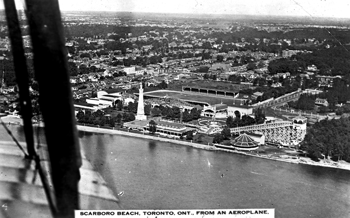
The photo above is from a postcard of Scarboro Beach Amusement Park taken from a plane in approx. 1924.