


Maps and Atlases
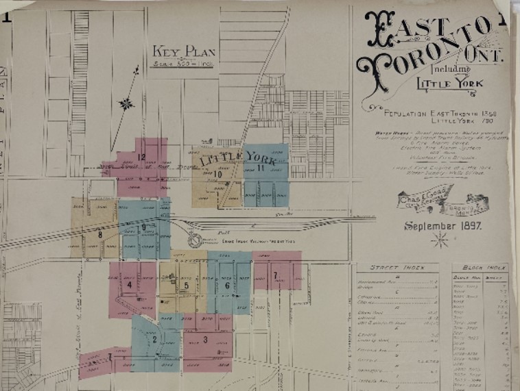
Detail. East Toronto Key Plan, 1897
Presented here are a series of maps of East Toronto published by the Chas. Goad Co. in 1897 and 1913. East Toronto was an independent municipality from 1888 until it was annexed to Toronto in December 1908. Originally a village, East Toronto had grown up around the Grand Trunk Railway's York Station, at Main Street south of Danforth. Although most of the village was north of Kingston Road, it did include a narrow section south of that to the edge of Lake Ontario. This took in Balsam and Beech avenues, and part of Queen Street. East Toronto became a town in 1903, when its boundaries were extended northeast to include Little York.
Also included for 1897 is the key plan and detailed individual plans for the local area between Woodbine and Carlaw avenues, Ashbridge’s Bay and Sammon Avenue (volume 6).
Peter Marshall of Hogtown House Histories
https://www.househistories.ca/